
What Rancho Palos Verdes’ Landslide Zones Mean for a Natural Hazard Disclosure
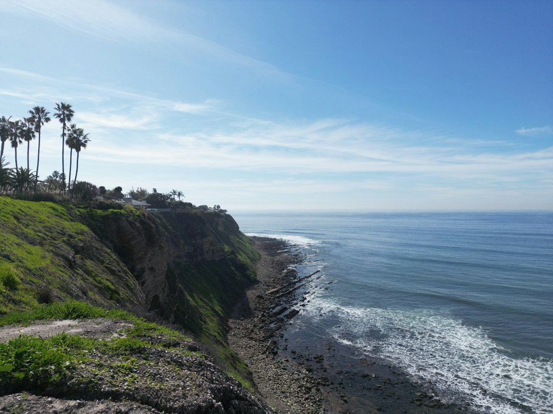
Rancho Palos Verdes has a landslide problem unlike almost anywhere else in California, and it changes what a seller legally has to tell a buyer before a sale can close.
The city’s Portuguese Bend area has been moving, in some form, for longer than the city has existed, and that history now shows up directly on the state-mandated Natural Hazard Disclosure Statement every California seller has to provide — not as an optional mention, but as a specific, checked box tied to state geologic hazard mapping.
Even owners well outside the area most affected by the 2024 emergency need to check whether their property falls within the state’s mapped landslide zone before assuming the issue does not apply to them.
A Slide That Predates the City Itself
Research cited by reporting on the area describes land movement at Portuguese Bend stretching back more than 250,000 years, long before any home was built there.
What changed the slide from a slow geologic process into a modern disaster was development: homebuilding and irrigation after World War II raised groundwater levels across the area, and a 1956 expansion of Crenshaw Boulevard disturbed the slide further. Between September 1956 and April 1957, the land moved roughly 22 feet.
By 1978, as movement kept accelerating, the city banned new construction in the Portuguese Bend area entirely, a moratorium that held for years and still shapes what can legally be built there today.
The 2002 Lawsuit That Reopened the Door
In 2002, fifteen property owners sued the city, arguing its building restrictions in the moratorium area had become an unconstitutional taking of their property.
A trial court initially sided with the city, but an appellate court reversed, ruling that the restriction amounted to an unconstitutional taking and that the city had to either allow construction on the plaintiffs’ vacant lots or buy the land at fair market value.
Homes were eventually built on some of those lots as a result of the ruling.
Three of them are now red-tagged — officially deemed unsafe to occupy — according to the city manager, which is about as direct a demonstration as exists anywhere in California of how a court-ordered development right can collide with an active geologic hazard years later.
What 2023 and 2024 Changed
Heavy rains in 2023 and 2024 accelerated the Portuguese Bend slide dramatically. The city declared a local emergency in 2023 as land movement increased, and received a FEMA grant of more than $23 million that year for mitigation work.
The crisis escalated through 2024: in July, SoCalGas suspended gas service to 135 homes in the area over safety concerns, and at points that year parts of the land were moving as much as a foot per week.
On September 2, 2024, Governor Gavin Newsom declared a state of emergency for the area, and officials cut electric power to 245 homes.
The city has since installed dozens of dewatering wells and drainage improvements aimed at reducing the groundwater driving the movement, and by early 2025 monitoring showed land movement had slowed significantly, allowing SoCalGas to begin restoring gas service to most affected homes by May 2025.
Even with that progress, officials and reporting on the crisis have continued pursuing additional federal disaster funds — cited at more than $40 million in some reporting — toward buyouts of the most severely affected properties, since experts are clear the underlying movement can be slowed but not stopped entirely.
For scale, the Portuguese Bend landslide complex covers roughly 260 acres, about 4% of the entire Palos Verdes Peninsula’s landmass, with an average slide thickness of about 135 feet, and it has deposited more than 5.8 million cubic yards of sediment into the ocean below over its history.
Why the Geology Here Is Different From a Typical Hillside Lot
The Portuguese Bend slide is not simply a hillside that erodes faster than average.
Geologic descriptions of the area point to seaward-dipping rock strata — layers of rock and soil that tilt gently toward the ocean — combined with inherently weak rock and continual coastal erosion at the base of the bluffs, a combination that creates a slow but essentially permanent tendency for the land to creep toward the sea.
That is a meaningfully different risk profile than an ordinary steep-slope property subject to occasional surface erosion or storm-driven slope failure: the Portuguese Bend movement is a deep-seated, ongoing geologic process that development and groundwater changes can accelerate but did not originally create, and no amount of surface drainage work alone can fully reverse it.
The City Cannot Stop a Private Sale
Despite the scale of the ongoing crisis, Rancho Palos Verdes has been explicit that it has no legal mechanism to halt a private property sale in the affected area, and homes within the broader landslide zone continue to be listed and sold.
That makes accurate disclosure the only real safeguard a buyer has, which is exactly why California’s statutory disclosure framework — not any city ordinance — carries the weight here.
A city cannot protect a buyer from a risk it cannot legally prevent the seller from passing along; only an honest disclosure can do that.
Where Landslide Risk Actually Shows Up on a Disclosure Form
California Civil Code Section 1103.2 requires every seller to complete a Natural Hazard Disclosure Statement covering six categories: Special Flood Hazard Areas under federal flood mapping, dam-inundation flood areas under Government Code Section 8589.5, High or Very High Fire Hazard Severity Zones under Government Code Section 51178, wildland fire areas under Public Resources Code Section 4125, Earthquake Fault Zones under Public Resources Code Section 2622, and Seismic Hazard Zones under Public Resources Code Section 2696.
That last category is the one that matters most for a Rancho Palos Verdes seller: Seismic Hazard Zone maps, prepared under the state’s Seismic Hazard Mapping Act, separately identify both liquefaction zones and landslide zones, and the standard NHD form has a dedicated line asking whether the property sits within a mapped landslide zone — separate from, and in addition to, the earthquake-fault-zone question most sellers are more familiar with.
Why a Clean-Looking Disclosure Can Still Be Incomplete
A seller who fills out the standard NHD checklist accurately, with a professional natural-hazard disclosure report confirming the landslide-zone status, has satisfied the state’s statutory checklist.
That is not the same as satisfying the separate, broader duty under Civil Code Section 1102 to disclose known material facts affecting a property’s value or desirability.
A seller in or near Portuguese Bend who has personally experienced foundation cracking, utility outages tied to ground movement, red-tagging of a nearby home, or direct communication from the city about the area’s active monitoring has actual knowledge that almost certainly qualifies as a material fact regardless of what any checked box on the NHD form shows.
The statutory NHD disclosure and the general material-fact disclosure duty are two separate legal requirements, and satisfying one does not satisfy the other.
A seller who treats the NHD checklist as the entire disclosure obligation, rather than as one piece of a broader duty, is the seller most likely to face a claim after closing.
How This Differs From an Ordinary Earthquake Disclosure
Most California sellers who complete an NHD form are dealing with the Earthquake Fault Zone question, tied to Alquist-Priolo fault maps that identify where surface rupture could occur directly along a mapped fault line.
A landslide zone designation works differently: it does not require the property to sit on or near an active fault at all, only within an area the state’s geologic survey has identified as prone to earthquake-induced slope failure.
In Rancho Palos Verdes, much of the risk is not really about shaking along a nearby fault — it is about the slope itself failing, with or without a major earthquake triggering it, as the ongoing Portuguese Bend movement demonstrates.
A seller who assumes the earthquake-fault-zone box is the only hazard question relevant to a coastal bluff property is missing the box that, in this city, often matters more.
Building Restrictions That Follow the Property, Not the Owner
The city’s position, as described by its own city manager, generally allows improvements to homes that were built before the city’s 1973 incorporation in the moratorium area, while new construction on vacant lots remains far more restricted outside of the specific court-ordered exceptions from the 2002 litigation.
These restrictions attach to the land itself, not to whoever currently owns it, which means a buyer purchasing a vacant lot or a severely restricted parcel in the moratorium area inherits the same limitations the seller had, regardless of what the buyer intends to build.
A seller who markets a vacant landslide-zone lot without clearly disclosing these restrictions is setting up a buyer for a serious and expensive surprise once that buyer applies for a building permit.
What a Natural Hazard Disclosure Report Actually Costs and Covers
Most California sellers order a natural hazard disclosure report from a third-party provider rather than researching each of the six NHD categories themselves, and the report typically also flags whether the property sits in other hazard categories the standard NHD form does not separately require, such as mapped earthquake fault setback zones from local ordinances or additional flood-risk data beyond the federal flood maps.
For a Rancho Palos Verdes property anywhere near the Portuguese Bend moratorium area, confirming that the report provider is actually checking current state Seismic Hazard Zone landslide maps — rather than an outdated version — is worth verifying directly, since the maps themselves have been revised over the decades the slide has continued moving.
A Worked Example
Consider a seller whose home sits just outside the Portuguese Bend moratorium boundary but within the broader state-mapped landslide zone — a common situation on the Palos Verdes Peninsula, since the mapped zone extends well beyond the specific area that made national news in 2024.
The home has no visible structural damage, gas and power service were never interrupted, and the owner has lived there for fifteen years without incident.
Even so, if the property falls within the state’s mapped Seismic Hazard Zone for landslides, the NHD form’s landslide-zone box must be checked yes, regardless of how uneventful the owner’s personal experience has been.
A buyer’s lender, seeing that box checked, may require additional geologic review or a higher insurance deductible before approving financing — not because anything is currently wrong with the specific house, but because the state’s hazard mapping, not the seller’s lived experience, is what the disclosure form and the lender’s underwriting are keyed to.
The seller’s own sense that the property has been fine for fifteen years is simply not the standard the system is built around.
Insurance and Lending Complications a Seller Should Expect
Standard homeowners insurance in California generally excludes earth-movement and landslide damage, which means a buyer in or near the moratorium area may face a narrower, more expensive insurance market than a typical California home purchase, and some lenders scrutinize landslide-zone properties more closely during underwriting given the history of red-tagged homes in the immediate area.
A seller who has not disclosed the property’s landslide-zone status early, and lets a buyer discover it only after the buyer is deep into a loan application, risks losing the buyer at a much later and more costly stage of the transaction than if the disclosure had been made at the outset.
When an As-Is Cash Sale Fits This Situation
A property well outside the Portuguese Bend moratorium boundary, in stable condition with no landslide-zone designation, does not need any special handling beyond the standard disclosure package, and a traditional listing is usually the better path to maximize sale price.
For a property inside or near the affected area — particularly one with visible ground-movement damage, insurance difficulty, or a buyer pool thinned by lending concerns — a cash sale to a buyer who underwrites the hazard directly, rather than one relying on conventional financing that may be difficult to secure, is often the more realistic way to close a sale at all, not just the faster one.
Waiting for the city’s stabilization and buyout efforts to fully resolve the underlying geology is not a realistic timeline for most sellers who need to move on from the property now.
This Is Not Only a Rancho Palos Verdes Issue
The Palos Verdes Peninsula landslide complex extends beyond Rancho Palos Verdes’ own boundaries, and the broader geologic conditions behind it — seaward-dipping strata and a history of slope instability — are shared, to varying degrees, by neighboring peninsula cities including Palos Verdes Estates, Rolling Hills, and Rolling Hills Estates.
A seller anywhere on the peninsula should not assume that a different city name on the mailing address means the state’s Seismic Hazard Zone landslide mapping does not reach the property; the maps are drawn by geology, not municipal boundary lines, and a parcel a few hundred feet from the Rancho Palos Verdes line can carry the same landslide-zone designation as one well inside it.
What a Buyer Is Entitled to Ask For
Beyond the standard NHD form, a buyer purchasing property anywhere near the moratorium area is entitled to ask the seller directly about any known ground-movement history, any city correspondence about monitoring or utility interruptions, and any insurance claims or denials tied to earth movement.
California’s disclosure statutes set a floor, not a ceiling, on what a seller must reveal, and a seller who answers these direct questions evasively — rather than simply disclosing what is actually known — risks a far more serious legal claim after closing than one who discloses fully and lets the buyer decide whether to proceed.
Given how closely this specific area has been covered in local and state reporting, a buyer’s agent working the peninsula is also increasingly likely to raise these questions unprompted, which makes getting ahead of them during listing preparation the more comfortable position for a seller to be in.
A Disclosure Checklist for a Rancho Palos Verdes Seller
- Order a current natural hazard disclosure report and confirm it reflects up-to-date state Seismic Hazard Zone landslide maps, not an outdated version.
- Check the NHD form’s landslide-zone line specifically — it is separate from the earthquake-fault-zone question most sellers focus on.
- Disclose any known ground-movement history, utility outages, or red-tagging in the immediate area under Civil Code Section 1102, regardless of what the NHD checklist shows.
- If the property is vacant land in the moratorium area, confirm current building restrictions with the city before marketing it as buildable.
- Flag the landslide-zone status early in the listing process so financing and insurance issues surface before a buyer is deep into escrow.
Selling an As-Is Property in Rancho Palos Verdes
If disclosure, insurance, or lending complications tied to a landslide-zone designation make a traditional listing difficult, Cash Home Buyers CA buys Rancho Palos Verdes property directly or brings in a vetted cash buyer who underwrites the hazard as part of the offer rather than treating it as a reason to walk away.
When you sell to us, we pay the standard closing costs, including the county and city transfer taxes, escrow and title. See our guide to selling a house as-is in Rancho Palos Verdes, request a no-obligation offer at Cash Home Buyers CA, or see our Google Business Profile right here. You can also call us at (424) 435-2326.